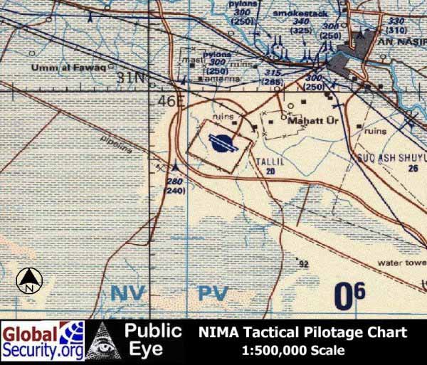
| Tallil Airbase is
located approximately 310 kilometers Southeast of Baghdad and 20 kilometers
Southwest of the city of An Nasiriyah. The airfield is served by two main
runways measuring 12,000 and 9,700 feet. Sited on sandy desert, the base
is capable supporting at least two fighter squadrons and support units.
According to the "Gulf War Air Power Survey", Tallil had 36 hardened aircraft
shelters. At the each end of the main runway are hardened aircraft shelters
knowns as "trapezoids" or "Yugos" which were build by Yugoslavian contractors
some time prior to 1985. Tallil occupies 30 square kilometers and is protected
by 22 kilometers of security perimeter.
The An Nasiriyah
weapons storage area is located about 7 kilometers to the East which occupies
7 square kilometers. This WSA appears on a 1985 Russian map but it is not
known whether it was struck during Operation Desert Storm, or Desert Fox.
As of June 2, 2002,
there is no Ikonos imagery of Tallil Airbase in Space Imaging's Carterra
Archive. |